
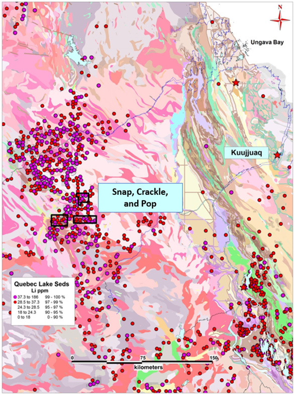
Manning controls a district-scale portfolio of exploration projects situated in the emerging Leaf River lithium camp. Leaf River is located 200 km WSW of the community of Kuujjiaq, QC (Figure 1).
The four separate projects, named “Snap”, “Crackle”, “Pop” and “Pow”, comprise a combined 65,785-hecatres (1,426 mineral claims). Several companies are now active in the area with multiple large land acquisitions having taken place in recent months.
The acquired claims cover some of the highest (99% percentile) lithium, cesium, and rubidium lake sediment anomalies in the entire Government du Quebec lake sediment database (SIGÉOM) that sit within favourable geological hosts of leucotonalites, granites, gneiss, and mafic basalts units.
The highly elevated lake sediment samples over favourable geology associated with regional magnetic structure and documented pegmatites represents an optimal environment for rare-element pegmatites.
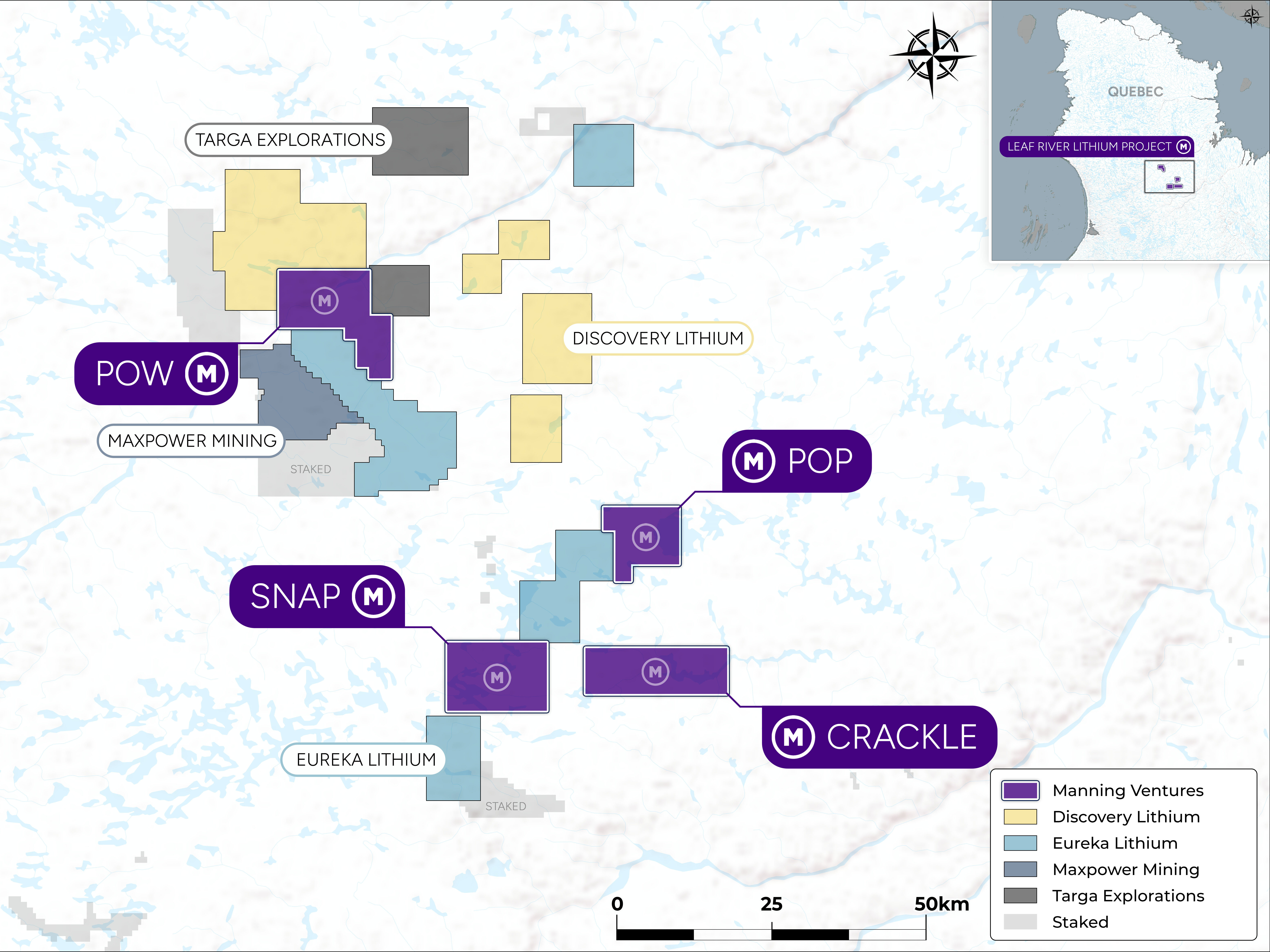
The Property is host to several known pegmatite outcrops but remains underexplored with little to no lithium -focused work having been conducted prior to Manning-Ventures.
No lithium-bearing occurrences had been noted despite several known pegmatite outcrops on the property.
Project selected as a result of a regional targeting method including a review of pegmatite occurrences across Quebec with the appropriate indicator-mineralogy and indicator-chemistry for hosting Lithium-Cesium-Tantalum (LCT) style, spodumene-bearing pegmatites, within favorable host-rocks.
Geology across all claim blocks consists of a mix of leucotonalites, granodiorites, granites, paragneiss, amphibolites, gabbros, and basalts. The magnetic data highlights NW and WNW trending structures which make excellent pathways for fractionating fertile parental melts.
The area is historically underexplored for lithium and presents a compelling ground-floor opportunity for significant discovery.
Qualified Person
The technical content of this news release has been reviewed and approved by Mike Kilbourne, P. Geo., (OGQ # 1971) who is an independent Qualified Person (QP) as defined in National Instrument 43-101, Standards of Disclosure for Mineral Projects.